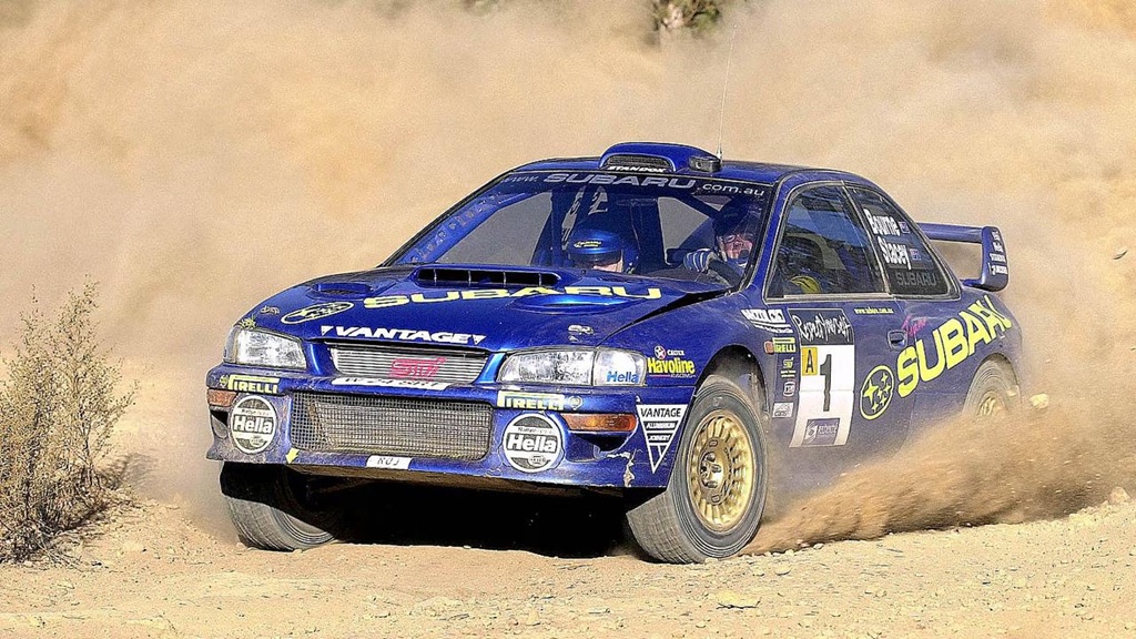
On the other side of the world, the 2026 Dakar Rally is underway. It’s a grueling 8,000 km, off-road race through the deserts of Saudi Arabia. Having commenced on January 3rd, the Dakar wraps up this Saturday, January 17th making it much more than a race. It’s an endurance test of man and machine, pushing competitors to their limits.
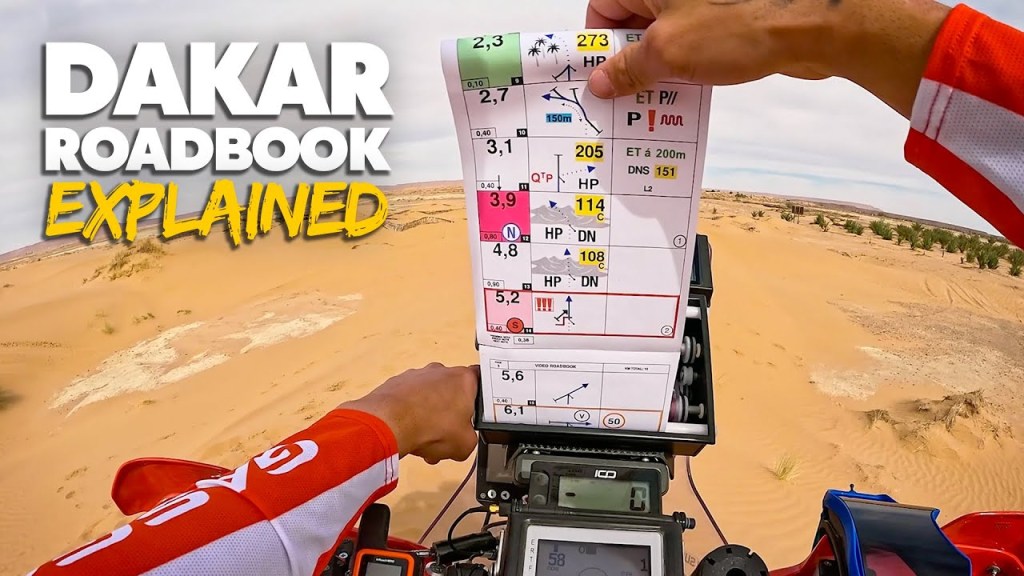
It would make sense for Dakar Rally racers to use GPS to guide them through the desert from one point to another. But organizers believe that using a fully-guided map, like a road car’s GPS, would simply be too easy. It would diminish the skills necessary to navigate the course.

Instead, the Dakar uses a paper scroll called a ‘roadbook’ which is essentially a turn-by-turn map guiding racers through each stage. The cryptic map contains symbols and instructions for distance, direction, and waypoints to test a competitor’s navigational skills. To maintains the challenge of traditional rally-raid navigation, the driver (and co-driver) must decipher information on the fly, matching odometer readings to the roadbook, just to stay on course.
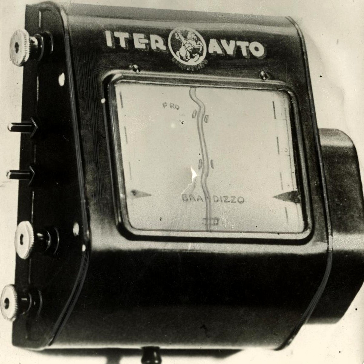
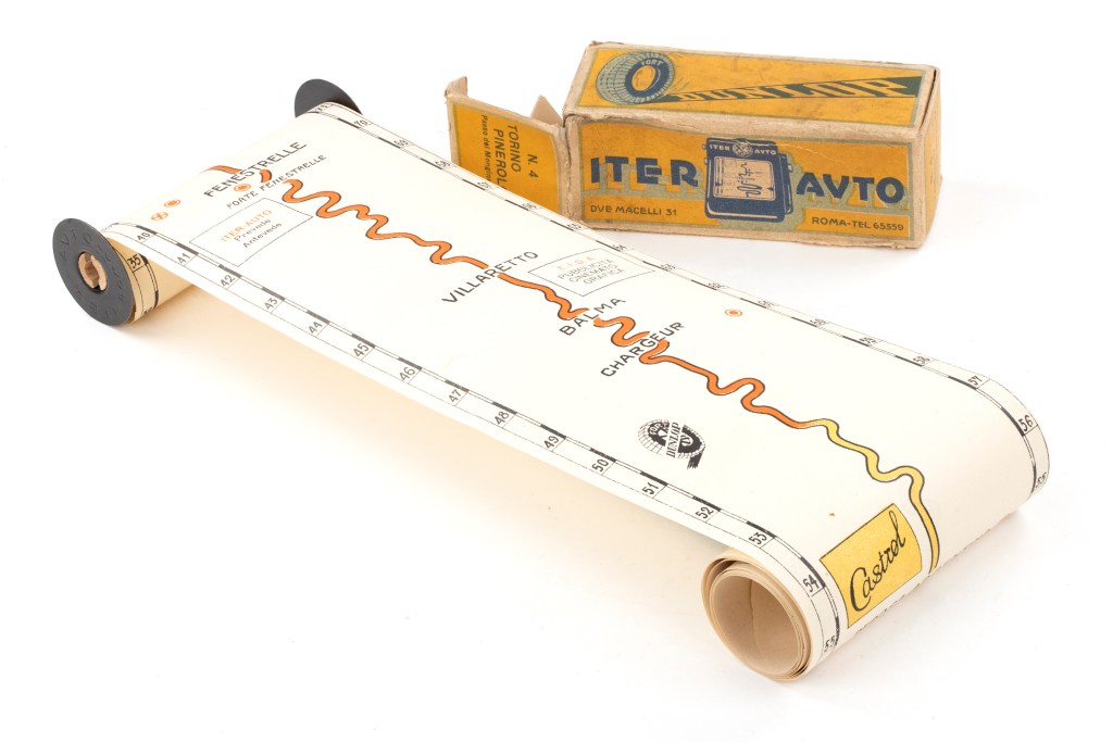
What makes this interesting is that the roadbook used in Rally Dakar today has been around since 1931. Developed by the Touring Club Italiano, the ‘Iter-Auto’ was a mechanical roadbook inside a metal box. Used to help motorists navigate from one city to another, the Iter-Auto contained a turn-by-turn road map on paper scrolls. Just 4″ wide but 80″ long, the Iter-Auto roadbooks were mechanically connected to a vehicles odometer to aid in navigation.

The scrolls inserted into the Iter-Auto were quite simplistic, without the level of detail one might expect from a roadmap today. Drivers were presented with a primarily white page and a yellow or orange ‘road’ down the centre. To help drivers better understand their location, the scrolls included mile markers, gas stations, bridges, railroad crossings, and cross streets. The scroll would automatically advance based on distance traveled according to the odometer.
Unlike modern GPS systems that can route a driver around a crash or road construction, veering off course or taking a wrong turn would render the Iter-Auto useless. However, the scrolls could be manually advanced or retracted once a driver got back on the original course and reached a noted landmark.
Considering the fact this technology is nearly a century old, and still in use in extreme sports like Dakar rally, is a testament to the engineering genius of the Touring Club Italiano.
That is awesome and appeals to my retro soul. Now I want one. I wonder if there’s a community of amateurs that still make maps for populated areas…
It is pretty cool, isn’t it? I like the idea that you could stop in to your local AAA and get a ‘scroll’ from Boston to Hartford.
I’m certain modern technology and GPS has killed any interest in these (with the exception of collectors) but it’s still very interesting that it’s used in rally raid. If there was ever a place GPS could help, it would be in the middle of the desert!
This is really cool! I’ve heard about the Dakar Rally so many times but had no clue what it actually was!
The Dakar is insanity on four wheels (sometimes two).
Dumb question but they stop and sleep every night right? Or how does that work?
Yes, the course starts at the crack of dawn, goes on for hundreds of kilometers, then they arrive at the bivouac. Kind of a campground. There’s food, showers and tents to sleep in. Very much roughing it.